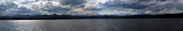
Lake Champlain joining the US and Canada. Adarondack Mountains of NY on the west and Green Mountains of VT on the east. It spans 120 miles and is some 4 miles at the widest point. The northern part is river-like, the middle wide with bays and islands, and the south again is river like. A strategic waterway during the French and Indian War, the American Revolution and the War of 1812, Lake Champlain has shipwrecks and forts everywhere.
Lake Champlain
Quiet Anchorage in Deep Bay
Friend Ross Keeps Watch
Dinghy Boy in the Rain
Rainbow in Deep Bay
Empty Fuel Dock (4 Bucks/Gal)
Burlington, Vt Harbor
Burlington, VT Church Street
Protesters in Burlington
Steamship Ticonderoga
Touring Steamship Ticonderoga
Controls on Ticonderoga
Blacksmith Shop Shelburne Museum
Can’t Afford a Boat?
Vergennes, VT
Big Johnson’s at Maritime Museum
Freedom Anchored at Crown Point
Fort Ticonderoga
Fort Ticonderoga
Fort Ticonderoga
Fort Ticonderoga
Duane picked us up hitch-hiking